My Hobbies
Walking
For many years I've enjoyed hillwalking and camping. My favourite place to walk is Buttermere, in the NW of the Lake District. If you fancy a relatively challenging daywalk have a go at Buttermere to Scafell Pike via the Corridor Route and back! I've been walking throughout the British Isles and I've got ambitions to venture further abroad soon - I'd quite like to visit South Island and western Mongolia among other places.
I'll try to add a section for walking photos at some point.
Cartography
One of my long-time personal passions is Cartography - the study of maps. As you might expect this involves plenty of time poring over atlases and the like, but there is more to it than that! An aspect I find many people don't quite grasp is my attempts to create "scientifically accurate" fictional maps. The very few reading this who have come across Artifexian, worldbuildingpasta or Madeline James might have an idea of what I mean, but I'll attempt to explain anyhow!
The aim is to model the evolution of a fictional Earthlike analogue planet over geological timescales using very rough rules of plate tectonics. This can become enormously complex and so our attempts are merely crude approximations of true tectonics, but I find the outcomes incredibly satisfying. The process allows one to imagine vast deserts, towering mountain ranges and far flung archipelagoes that don't exist on Earth - and in turn the flora, fauna and cultures that could develop in such places. As you might realise, this essentially acts as a method of producing vivid, believable settings in which any story you like can be told.
The general method is as follows:
- Create a supercontinent - think Pangaea.
- Split up the supercontinent into smaller continents in the same way we believe Pangaea did.
- Model the subduction zones that dictate the motion of these continents.
- Eventually bring the continents back together, forming a new Pangaea.
- Repeat until you end up with something you like!
At all stages throughout this process we also model various landforms (including marine ones) that would appear given the motion of the continents. We want to repeat the steps several times so we have an interesting range of landforms both new and old at the end.
It is possible to do this by hand, but doing it digitally has many advantages. Unfortunately, the easiest method on computer is to use a piece of modelling software called GPlates. This is intended for use by academics, and so isn't especially intuitive (to understate it!). If you do manage to get through the painstaking process of using GPlates without any new medical diagnoses then the results are really worth it! You end up with a digital record of your world's geological history that can be exported in several different map projections. Here's an example:
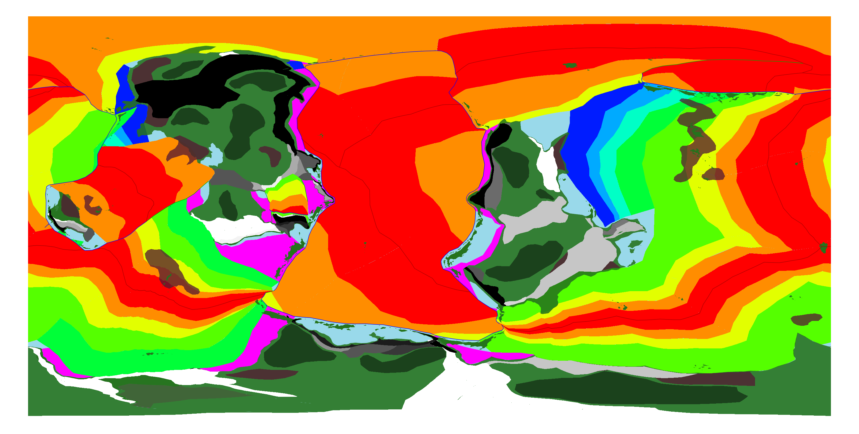
And without oceanic crust age marked:
I've decided my planet will have radius about 3.5% greater than Earth's. To put that in perspective the small continent in the far west (which I've dubbed Galois) is about the same size as Kazakhstan, while the large tropical continent in the east (called Cayley) is roughly the size of Asia. I wanted this planet to have large oceans, so only ~20% of the surface is covered by land, compared to Earth's 29%.
So far this is the only simulation I've completed in GPlates, but I'm fairly happy with the end result. I'm in the process of creating a topographical version of the map in Inkscape, so I'll try to post updates on this as it progresses.
As a final note, I'm not too fussed about the actual scientific accuracy of all this. If you have a go then allow yourself plenty of room for artistic licence; the real satisfaction is that you'll end up with a highly detailed and "believable" map. Imagine if ASOIAF or LOTR had a 4k topographical map to help visualise the scale of the story!
If you think any of this sounds interesting then do check out Artifexian, worldbuildingpasta and Madeline James' work - they've put in a lot more effort than I!